New dramatic weather maps have revealed that severe thunderstorms are set to hit parts of the UK this Sunday, with meteorologists warning of heavy rain, strong winds, and possible disruption across southern and eastern regions.
Low Pressure System to Sweep in From the South
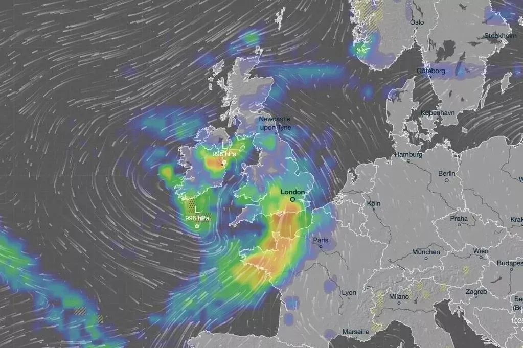
According to the latest data from Ventusky and Metdesk, a band of low pressure will move north from the English Channel, bringing gusts of up to 45mph and intense downpours. The system is expected to be most severe across the Southeast and East of England, including Kent, Sussex, Essex, and Suffolk.
The worst of the weather is forecast for Sunday evening, around 7pm, continuing through the night into Monday morning. Forecasters predict up to 17mm of rain in just three hours in some coastal areas.
Follows in the Wake of Storm Amy
This latest stormy spell follows Storm Amy, which struck earlier this month and tragically claimed a life in Ireland. Although the Met Office has not yet named the new system, meteorologists have expressed concern about the volume of rainfall and the strength of the winds expected on Sunday.
Areas Most at Risk
The coastal regions of East Sussex, West Sussex, and Kent are set to bear the brunt of the storm, while London, Essex, and Suffolk are expected to experience heavy rain later in the night as the system tracks northwards.
By early Monday, the band of rain is forecast to reach Norfolk before gradually pushing into the North Sea.
Temperatures to Drop as Winds Strengthen
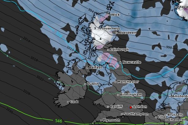
After a mild and balmy week — with highs of 18.6°C in Aberystwyth and 18°C in Shoeburyness — temperatures will drop sharply as the storm moves in. The southerly gales will make it feel as low as 9–10°C across parts of Southeast England on Sunday afternoon and evening.
The strongest gusts are expected along the Hampshire to East Sussex coastline, reaching up to 45mph, before shifting to westerly winds overnight and weakening slightly over Kent.
Fog and Light Rain Before the Storm
The Metdesk forecast also warns that morning fog will blanket much of the UK later this week, particularly on Friday across Wales, the Home Counties, and the Midlands.
No significant rainfall is expected before Sunday’s storm, with only light showers forecast for Southeast England on Thursday.
Met Office Long-Range Outlook
In its latest outlook, the Met Office said:
“Low pressure systems will likely move west across the UK, bringing spells of rain — heavy at times — and periods of stronger winds.”
This means more unsettled conditions are possible heading into late October, following what has been one of the warmest starts to autumn in recent years.